
Hiking Tolimán Volcano
In early December we hiked Volcán Acatenango, near Antigua, Guatemala. The day we hiked up happened to be Mark’s 68th birthday. For my 61st birthday at the end of December we tossed around the idea of hiking up Volcán Tolimán (we’re already in shape to hike a volcano…why not!?). I have wanted to hike Tolimán since I first moved to Guatemala in 2011: my house sits between Tolimán and the lake. Better 10 years than never, right?
It took another two weeks to get the trip organized, but we did it on January 12-13. 2021.
When you look for information about hiking Guatemala’s volcanoes, you can find dozens of blog posts and organized tours for the better-known hikes, such as Pacaya, Acatenango, and Fuego. If you search by location, you’ll find tours for San Pedro (on Lake Atitlan), Santiaguito and Santa Maria (near Xela) and Tajulmulco and Tacaná in San Marcos department. After that, information gets thinner.
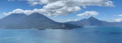
With three volcanoes dominating the skyline of Lake Atitlán, you’d think there would be more information about the two taller volcanoes: Atitlán and Tolimán. The information available about hiking those two is sketchy and often wrong. Fortunately, we have our own source of information on hiking those volcanoes: Mark’s son, Kyle, who has hiked them many times.
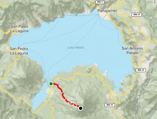
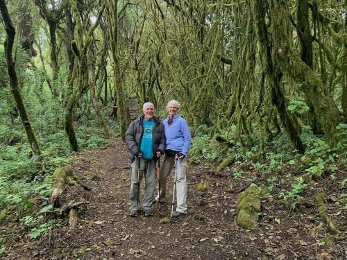
Kyle connected us with a local guide, Arnoldo, based in Santiago Atitlán. We arranged to meet him at the Hotel Bambú parking lot at 9am, and our hike began there. This was a guided hike but not an organized tour: we brought all our own food and gear, and hired a porter to carry our gear. Since we had so recently done the Acatenango hike, we were well-prepared with what to bring.
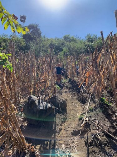
The hike begins with a pretty gentle climb though coffee fields and then corn fields. The trail is narrow and a bit rocky, but well maintained. After a couple hours, you enter the forest, and the trail becomes wider and steeper.
There are three camps between the beginning of the forest and the summit. The lowest camp was occupied by a crew maintaining the trail. We were told that their work is part of a program to preserve the forest instead of cutting down the trees. At the second, unoccupied, camp, we stopped for a lunch break. Our guide told us we had about two more hours to go to reach our camp.
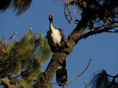
The next two hours were like climbing steep staircases through incredible cloudforest. The only animals we saw were an owl, tucanet, and turkey-like pavo de cacho (horned guan in English), which hang out up in the trees. Our guide pointed out scat from a puma and said he’s seen them in the area, but we did not see one.
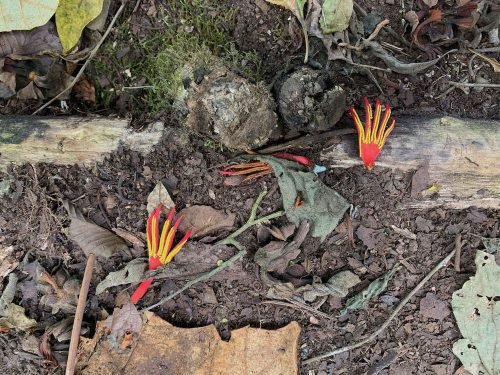
The most striking plant we saw was the Mano del Diablo. It’s flowers demonstrate the source of its name.
The last hour of hiking was steep. I knew I would make it, but I don’t think I’ve ever had to stop so many times to catch my breath.
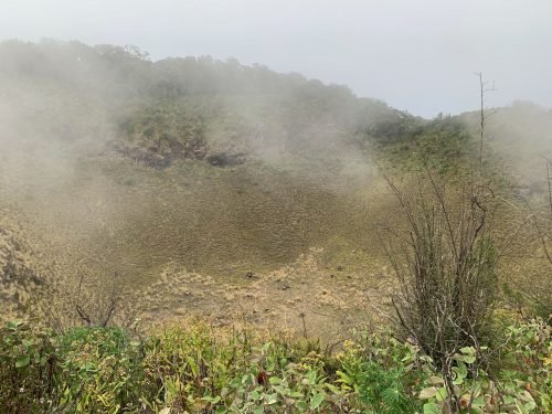
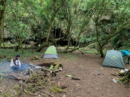
We reached our campsite around 3pm: about 4.5 hours of hiking and 1.5 hours of breaks. We set up camp (in a spectacular grotto, complete with a cave in the back) and rested a bit, then passed through more incredible forest before reaching the crater: an enormous, grass-lined bowl. The clouds were rolling in, so we didn’t get any views on the way.
The 20 minute hike back to our camp got us there in time to make dinner before the sun set. We enjoyed some time around the campfire before turning in early. I enjoyed the best sleep I can remember having in a tent.
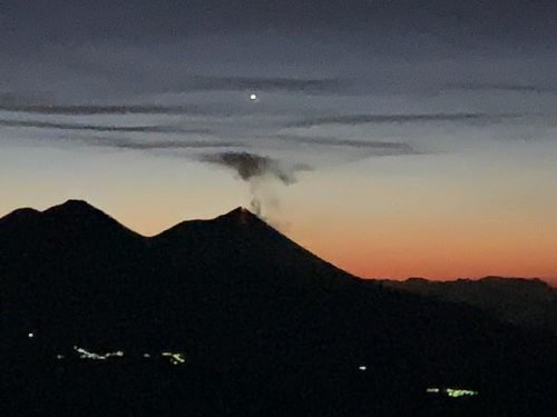
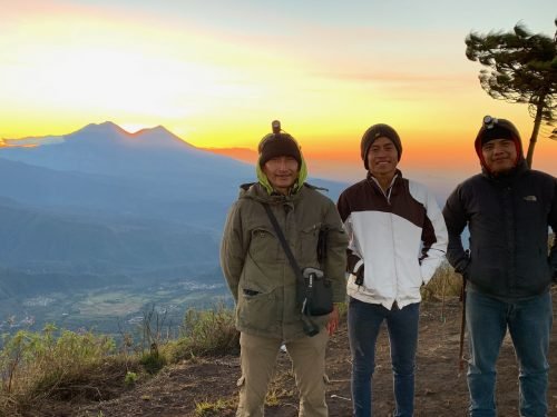
We got woke up at about 4:45am for the 5:30 departure toward the summit. From camp it’s a pretty easy hike, though dark and cold. Our reward was seeing the sky starting to change colors being Acatenango and Fuego volcanoes, with Venus perched directly above Fuego.
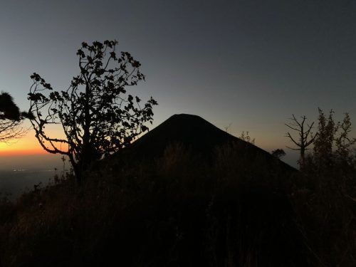
As we waited to see the sun come up, we looked toward Atitlán volcano, next to us. Above the peak was the Southern Cross, and as we caught a meteor going by above it. We thought it was too much for one morning.
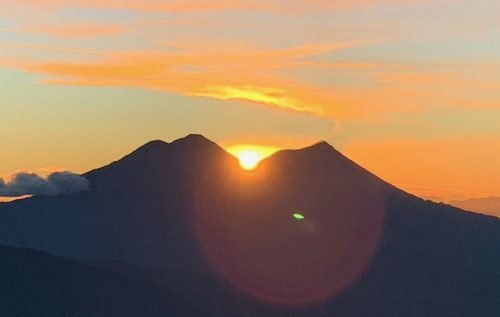
And then the sun rose. It just happens that at this time of year, the sun comes up exactly between Acatenango and Fuego. Just that was worth the hike, the early morning, and the cold wind.
It was a quick hike down to breakfast before breaking camp and hitting the trail at 8:15am. The first part of the hike down was not as difficult as I expected considering how steep it is. I had more trouble when we got down to the narrow, rocky part of the trail, though I only fell once. The hike down took us about 4.5 hours (including a few short breaks).
The Tolimán hike was about 10km each way, with an elevation gain of about 1500 meters (Toliman’s elevation is 3158 meters). It was stunning, rewarding, and the most physically demanding activity I’ve done since my 20s.
Share this post!