
Hiking Atitlán Volano
The past year has been a big one for us and adventures. On December 2, 2020 we hiked up Acatenango. In January 2021 we hiked up Toliman volcano. In April we circumnavigated Lake Atitlan. This December 2, we completed the year’s volcano trifecta by hiking up Atitlán volcano.
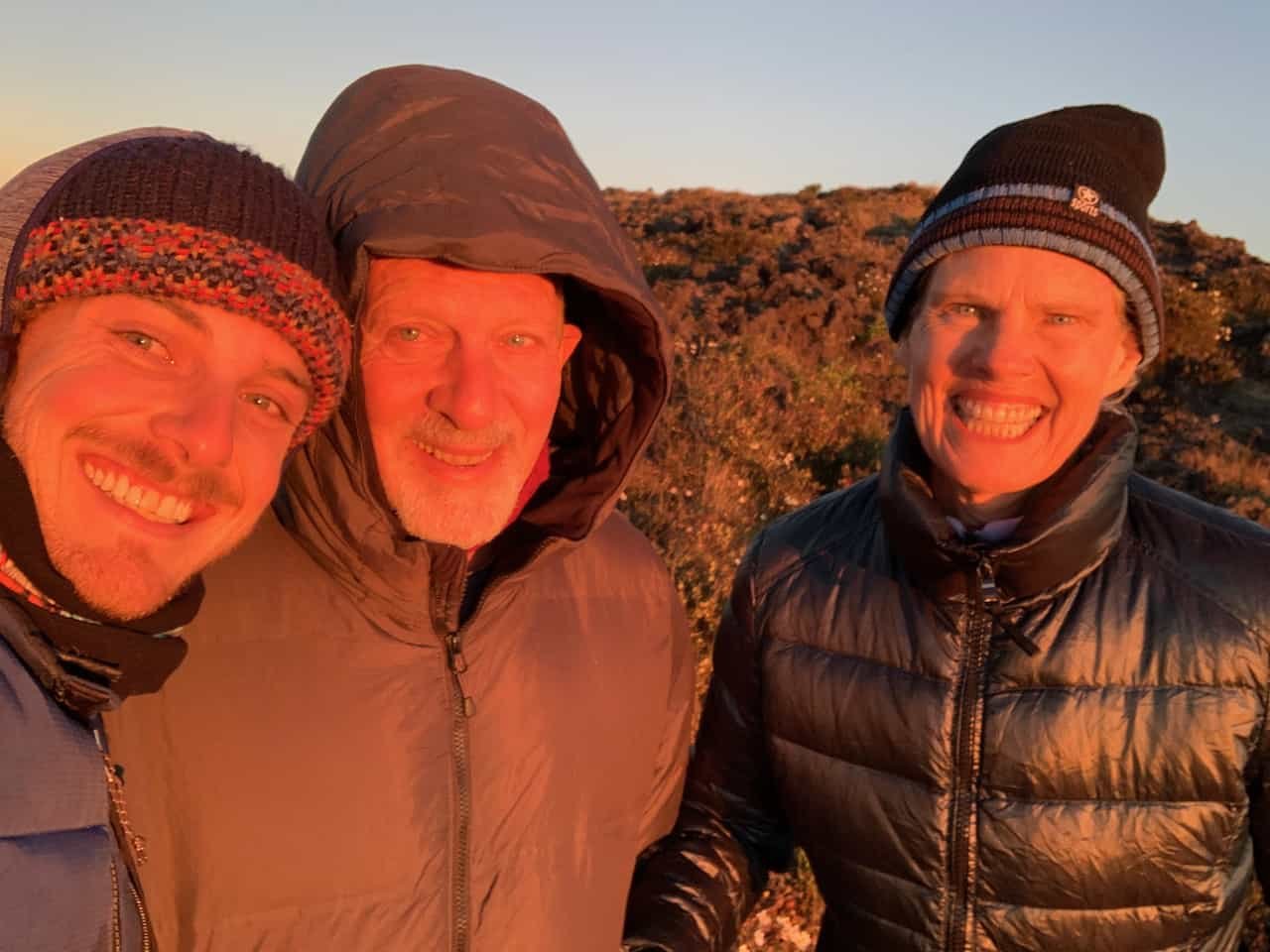
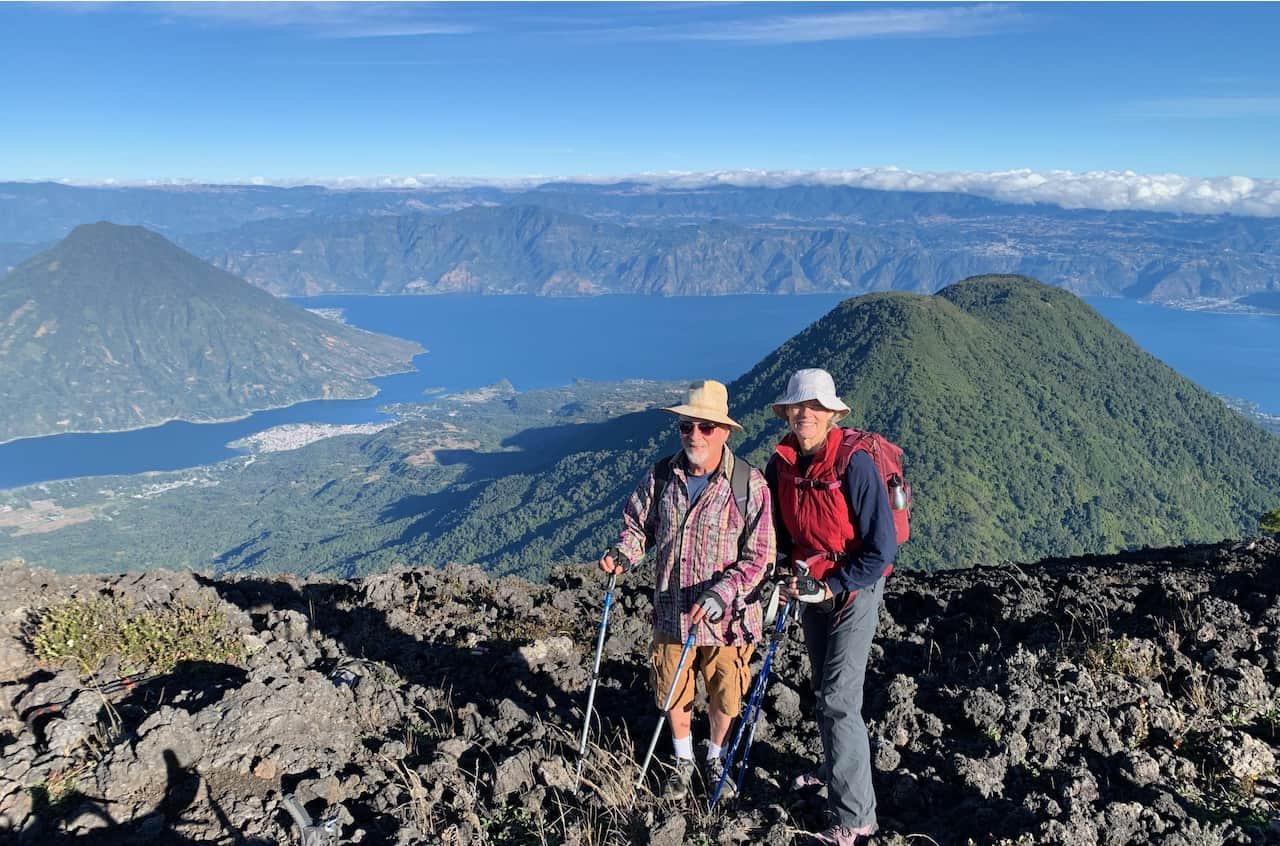
This time we were fortunate to have Mark’s son, Kyle, join us for the adventure–his gift for his dad’s 69th birthday. Kyle has hiked many volcanoes in Guatemala and has hiked Atitlán dozens of times. He warned us that Atitlán is the hardest of all the volcanoes he’s hiked in Guatemala. (He’s also an amazing photographer: follow him on Instagram!)
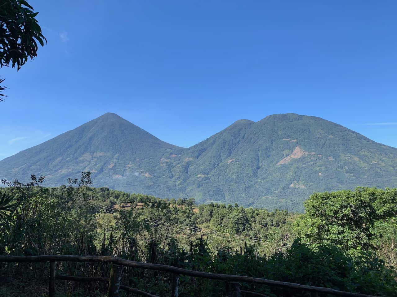
Atitlán volcano is the only one of the three large volcanoes on Lake Atitlán (along with Tolimán and San Pedro) that is considered active. It had more than a dozen eruptions recorded between 1469 and 1853: the date of the most recent eruption. Some say it is overdue for another eruption. At 3535 meters / 11,598 feet, Atitlán is the tallest of the three.
Note: Always use a local guide when hiking volcanoes in Guatemala. Be prepared for a strenuous hike up and a very strenuous hike down. If you are camping at the summit, expect a cold and windy night.
We met our guide, Arnoldo, and our porter, Salvador, at the Hotel Bambu in Santiago Atitlán. We loaded our gear and ourselves into a pickup truck and rode a few kilometers outside of Santiago to the trail head, near Mirador Rey Tepepul. We hit the trail at 8:30am.
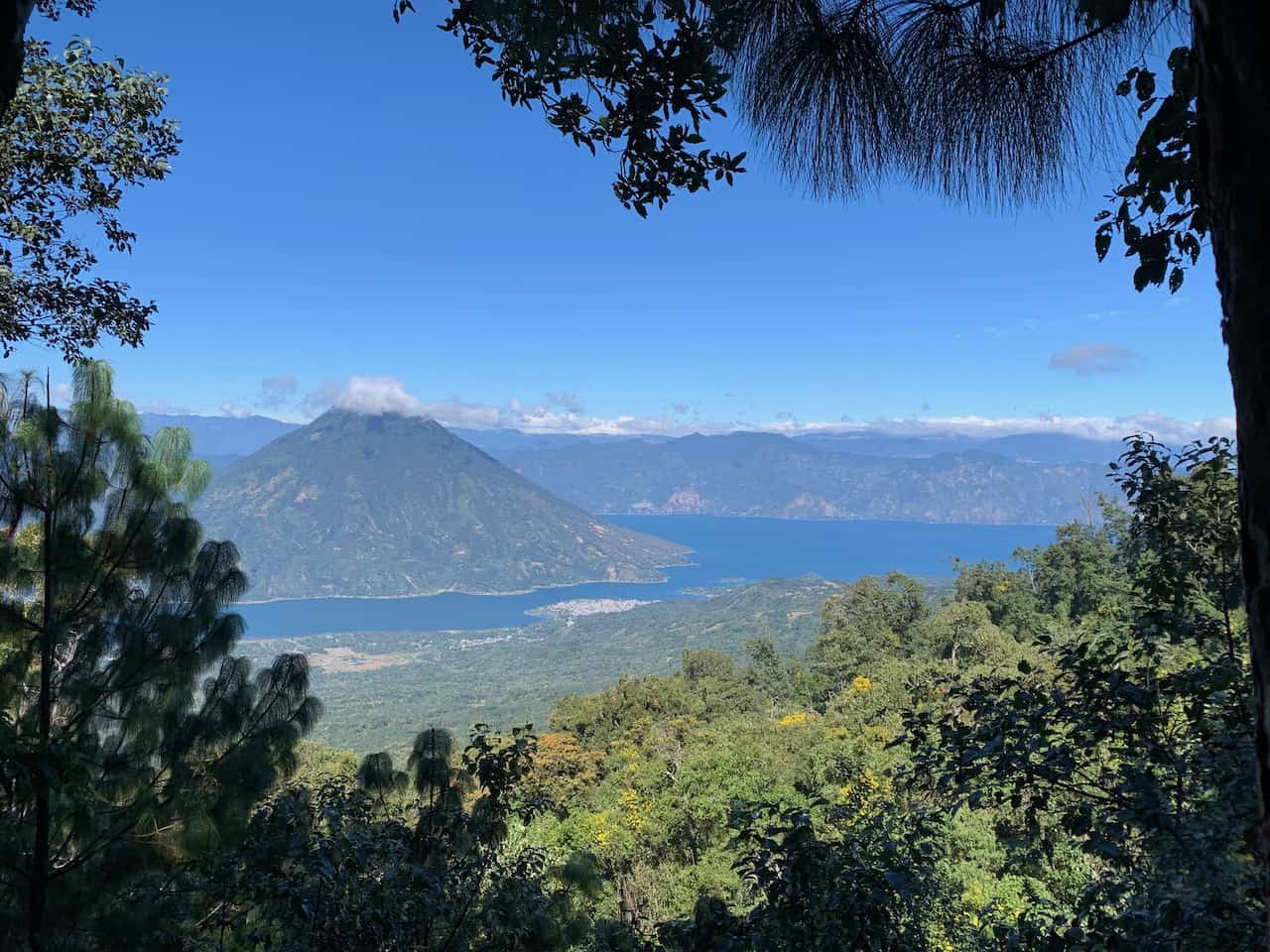
The first section of the trail is pretty mellow, with a gentle ascent. There are five rest stops along the way, and each stop marks the beginning of a steeper ascent. The third stop, called La Ventana (the window), has a lovely view of the lake.
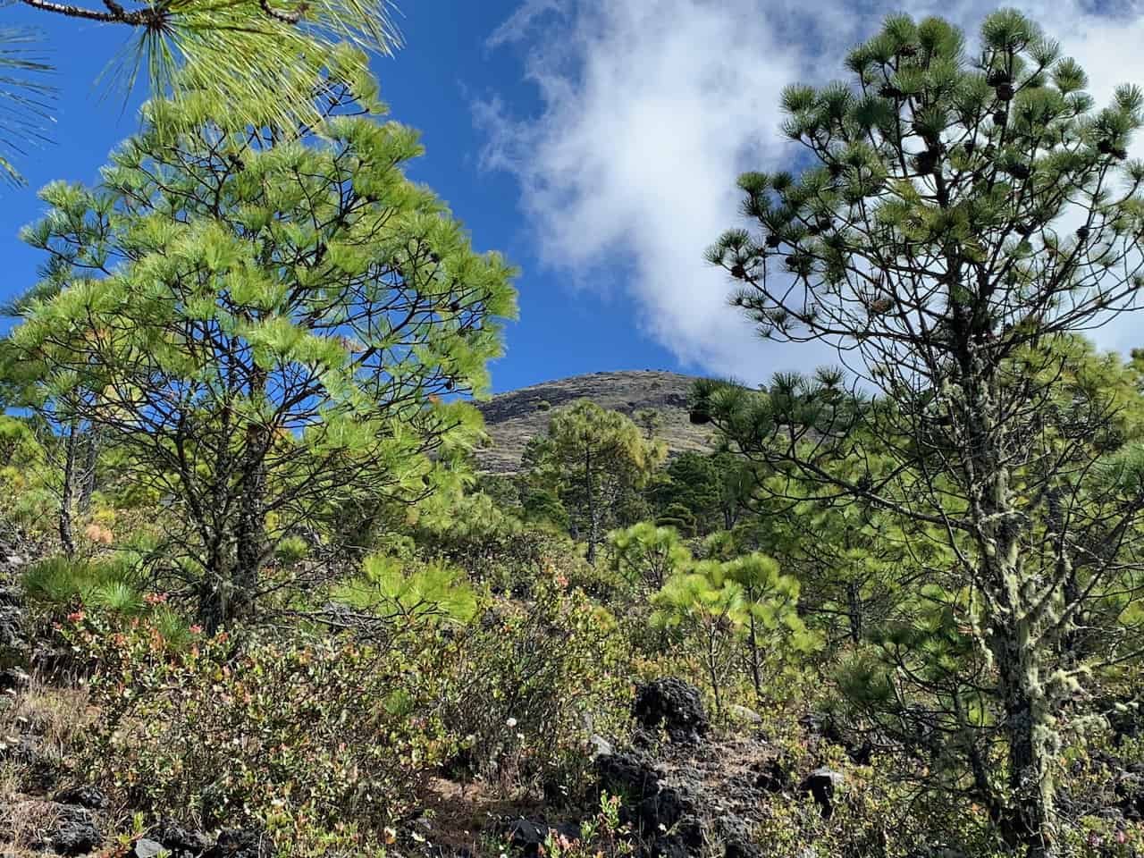
At about 1pm we took our last rest stop in the trees and got our first look at the summit from the trail. The cone of Atitlán is above the tree line and the trail is a path through volcanic rock. It’s the only part of the trail that is exposed, and on a sunny day can be hot and grueling.
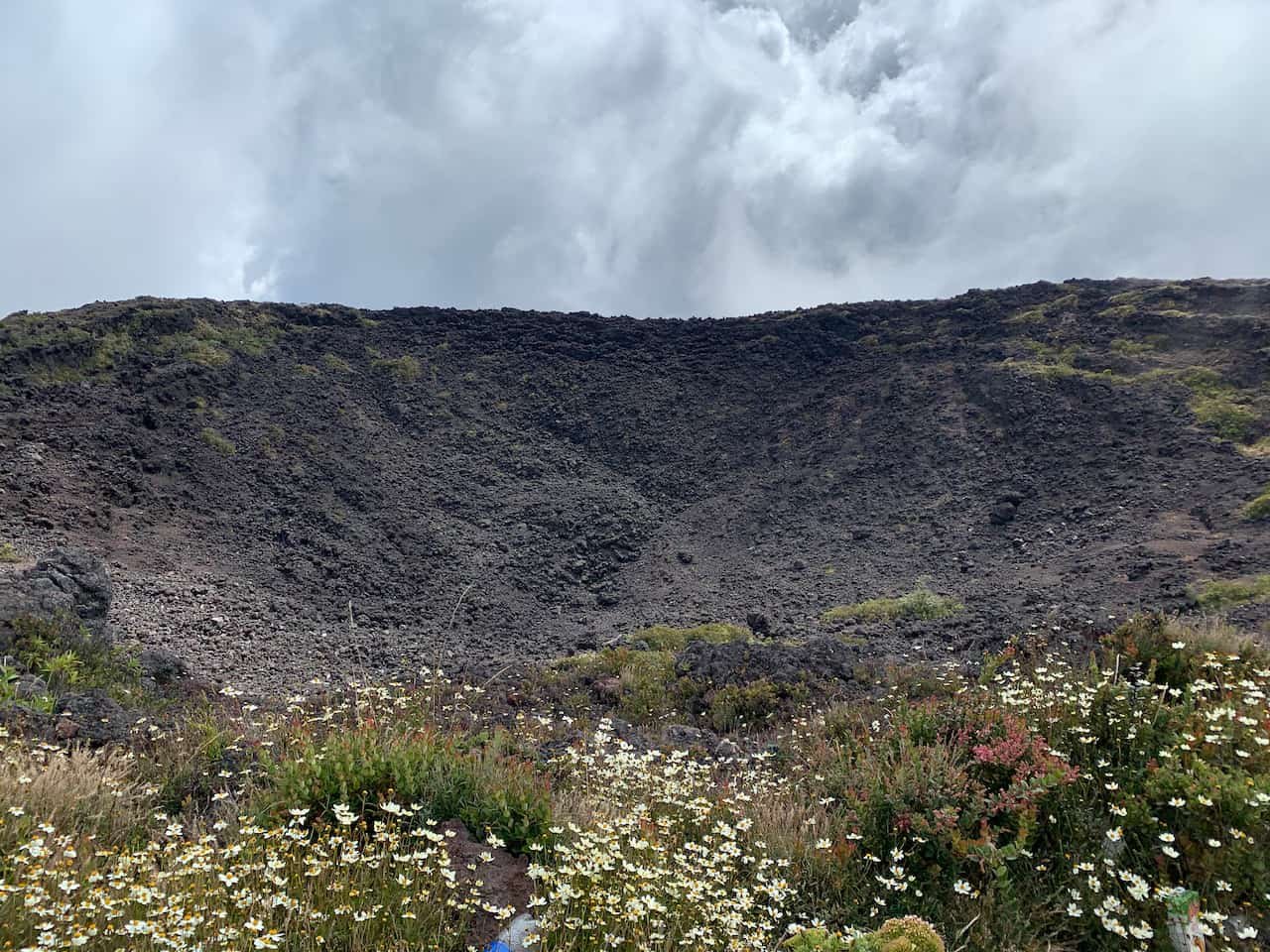
We reached our campsite at about 2:30pm. One of the reasons we planned a weekday hike is that on weekends there can be a lot of people up there vying for the best campsite. Fortunately, we had the summit to ourselves. The campsite is just a few meters down from the top on the south side, on the edge of the crater, and is protected from the wind.
<Begin Rant> Unfortunately, many campers leave their trash and we had to work around empty cans, plastic containers, and booze bottles. There is a special place in hell for people who leave their trash and sully a beautiful natural area like that. <End Rant>
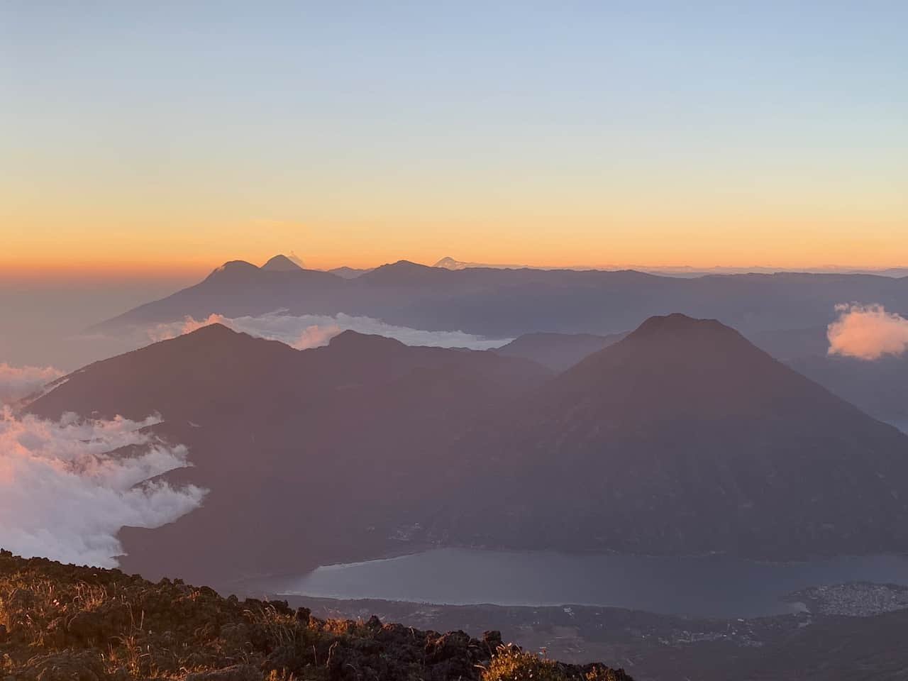
We spent the afternoon watching the clouds rise up from the Pacific coast (which in Guatemala is south). Sunset gave us a lovely view of the clouds and several other volcanoes in the distance, including Tajumulco–the highest peak in Central America–at the Mexican border.
The colors of the sunset gave us a nice opportunity for a selfie.
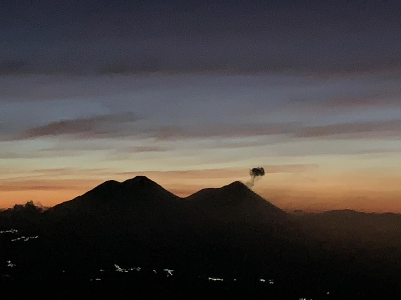
After a windy night, we got up at 5am and awaited the sunrise in a sheltered area: the wind out of the shelter is brutal. We were rewarded with a view of several small eruptions by Fuego volcano and a gorgeous painted sky.
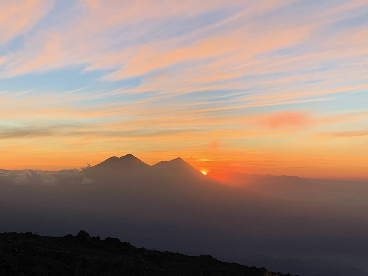
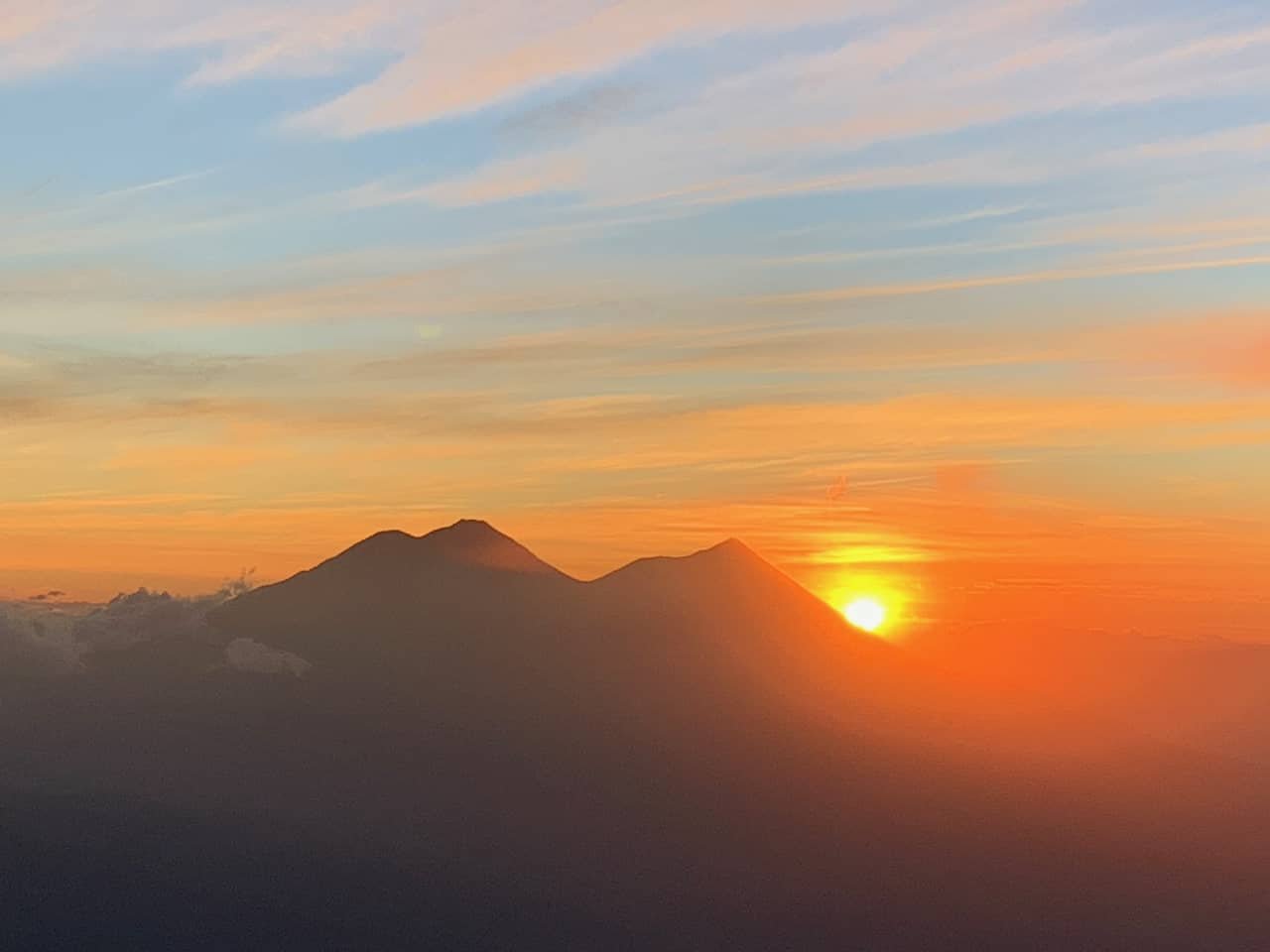
The sunrise was worth the early morning in the wind.
After sunrise our guide had a lovely fire waiting for us. We warmed up and broke camp, knowing it was going to be a long day on the steep hike down. We started down the trail at 8am.
The trail is in good condition the whole way, but the rocks and acorns make it slippery. It took us a bit longer to go down than to go up because my bad knees cause me to hike down at a snail’s pace. We made it back to the trail head at around 2:15 pm.
Hiking Atitlán was one of the most physically demanding things I’ve ever done, and certainly the most demanding since my 20s. We lucked out with the weather, and it was worth every strenuous minute of hiking. Next time, though, we’ll go for an easier volcano!
Share this post!
Thank you so much for sharing from your Blog! I keep returning to read and peruse your photography over and over. I continue to be very impressed at your hiking and climbing experiences. They are a.pleasant uplifting of my spirits each time I go through your words and photos.
Love you, dear daughter!
I’m so glad you enjoyed the story. It was quit the adventure!