Hiking Acatenango Volcano
For all of 2020’s many challenges, the year gave me a chance to cross something–besides “survive a pandemic”–off my bucket list: watching the sun rise from the summit of Acatenango Volcano.
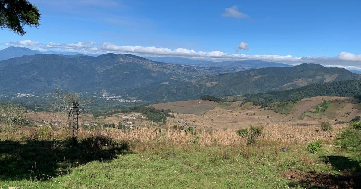
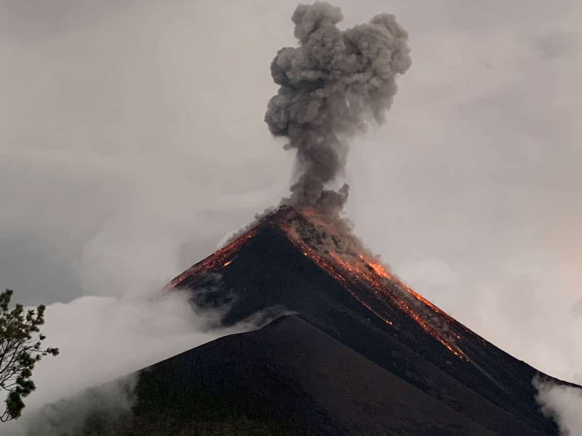
Acatenango is located in the heart of Guatemala, near the city of Antigua. I’d heard about the hike for years: you hike up to the base camp, get a little sleep, and get up at 4am to hike to the summit for the sunrise. Overnight, you watch and listen to the booming eruptions of Fuego volcano, Acatenango’s sister, just to the southwest.
However, I hadn’t seriously pursued the idea until a friend asked if we wanted to join him and his family on the hike, scheduled for December 2-3. Since December 2 is Mark’s birthday, it seemed the perfect way to celebrate. In more than 40 years of living in Guatemala, Mark had never been on Acatenango.
Our friend Jim, who organized the hike, got a guide recommendation for Leonel Azurdia of Guatemala Alternative Tours. Unlike some of the more budget-conscious tours, our tour included meals (yes, he could do vegan meals) and camping gear. All we would need to carry would be our clothing and personal items, water, and snacks. And we could hire a porter to carry those if we chose.
We had about two weeks to prepare, so I busily started reading blog posts about the Acatenango hike, I found a wide variety of experiences. Some complained about the small meals; others complained about not realizing they’d have to carry the camping gear, even though it was provided. Others claimed they couldn’t go to the summit because nobody told them they’d need a headlamp. Nobody complained about the view from the top of Acatenango.
All of these posts gave me good questions to ask Leonel and good advice about what to bring. It turned out that our experience was quite different from what others wrote about.
Most travelers who hike Acatenango start from Antigua. The travel companies provide shuttles from Antigua and back. We live in Panajachel and have our own cars, so we drove on our own, leaving Pana at about 6:30am. Our group was just the seven of us (Jim’s family, Mark, and me) so we didn’t have to worry about a timetable for meeting up with a group.
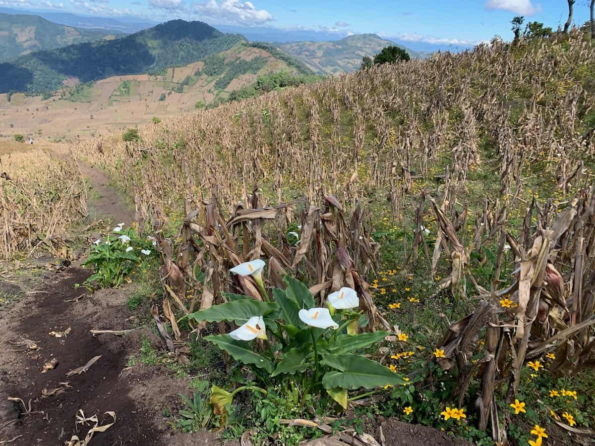
Typically the hike starts at the village of La Soledad. We opted to start at the finca Miratenango, which saves about 1.5 hours of hiking over sand. Many bloggers I’ve read said that was the hardest part of the hike. There’s a restaurant next to a field where people often stop after that first segment. We started from there.
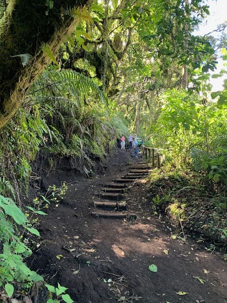
We got under way at about 9:30am. The first hour took us up a fairly steep path though open fields, then we got into the woods and the switchbacks started. Another hour of hiking on a small trail, and we met up with the main trail. Here we stopped for lunch.
I had talked to Leonel in advance about having vegan meals, and he was quite accommodating. Still, you never know what you’re going to end up with. Imagine my delight when I opened lunch and found a big salad with lettuce, carrots, corn, black beans, garbanzos, avocado, and an avocado dressing. Yay! (The meat eaters had chicken on theirs.)
We continued hiking up. It wasn’t until the last hour of the hike that I started to wonder how the hell I was going to make it back down. My creaky knees would not be happy. There are some downhill parts as you make the final hike to the campsite, and I slowed way down on those.
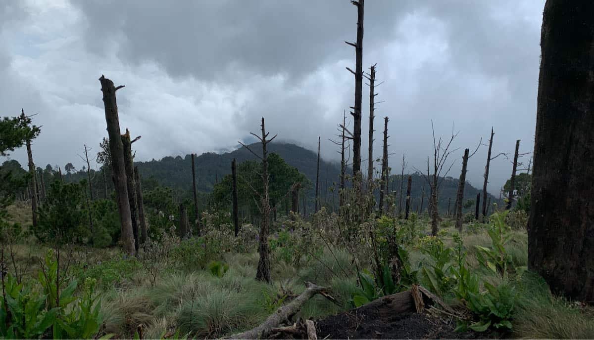
We had a little rain on the way up, and the clouds obscured the view. It was nice and cool, though.
We got to base camp at 2:30pm (that was with an hour break for lunch and several short breaks along the way.) According to my hiking app, the ascent to base camp was 2.4 miles (3.9km) with an elevation gain of about 3200 feet (975 meters). Base camp is at about 12,000 feet (3660 meters).
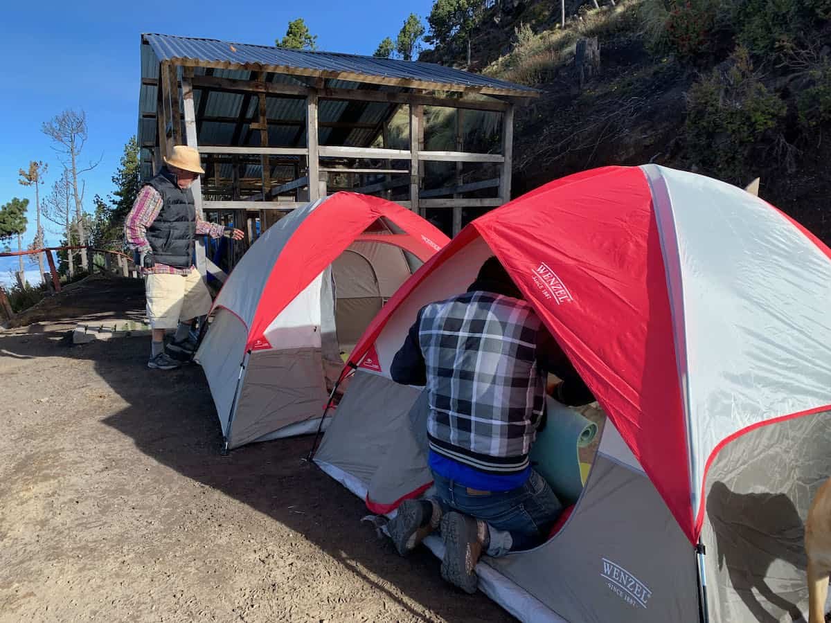
Camp was all set up for us. All there was for us to do was munch on snacks and watch the explosions on Fuego volcano. The whole area is dotted with camping spots. The one where we were was more permanent than others. There was a shelter area so we could get out of the rain. There was also an outhouse, which I didn’t expect, and a shed where the staff prepared our meals and slept. We had benches on three sides of a fire pit, so we could sit by the fire and watch Fuego’s show. We had the added entertainment of lightening behind Fuego.
Our veg dinner was overcooked pasta with a tomato mushroom sauce. I was so hungry that it was divine.
We all headed into our tents at about 7:30pm. Sleep was fitful at best. Between the hard ground (our sleeping pads were very thin) and the booms from Fuego, I woke up every 1/2 hour or so. We slept in all our clothes except our jackets, and Mark was kind enough to give me his jacket to augment the thin sleeping pad.
I woke up at about 3am and couldn’t go back to sleep, so I was out watching Fuego’s show when everyone else got up just before 4am.
I was a bit unsure whether I’d be able to hike up. At bedtime I noticed that the sole of my left shoe was coming off. Our guide gave me some twine to tie it back on, and up we went in the dark.
The trail is steep and a bit rocky, and my hands were numb from the cold (my knit mittens were not up to the job.) It took an hour of hiking before my hands weren’t numb anymore.
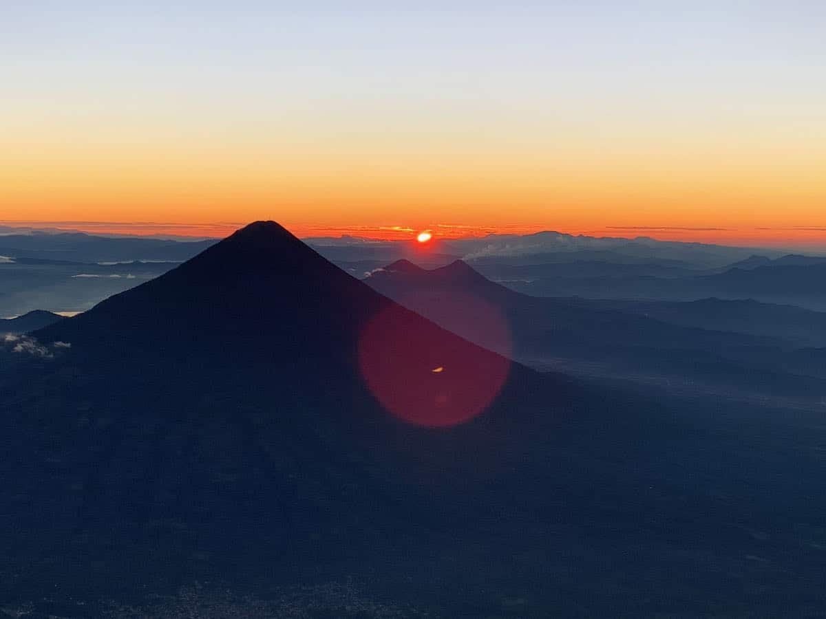
I didn’t use my hiking tracker, but I’m told that this part was a 1000 foot (300 meter) elevation gain (the summit is at about 13,000 feet / 3965 meters). We made good time, though, and got to the top around 5:30am… in plenty of time to watch the sunrise.
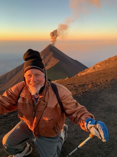
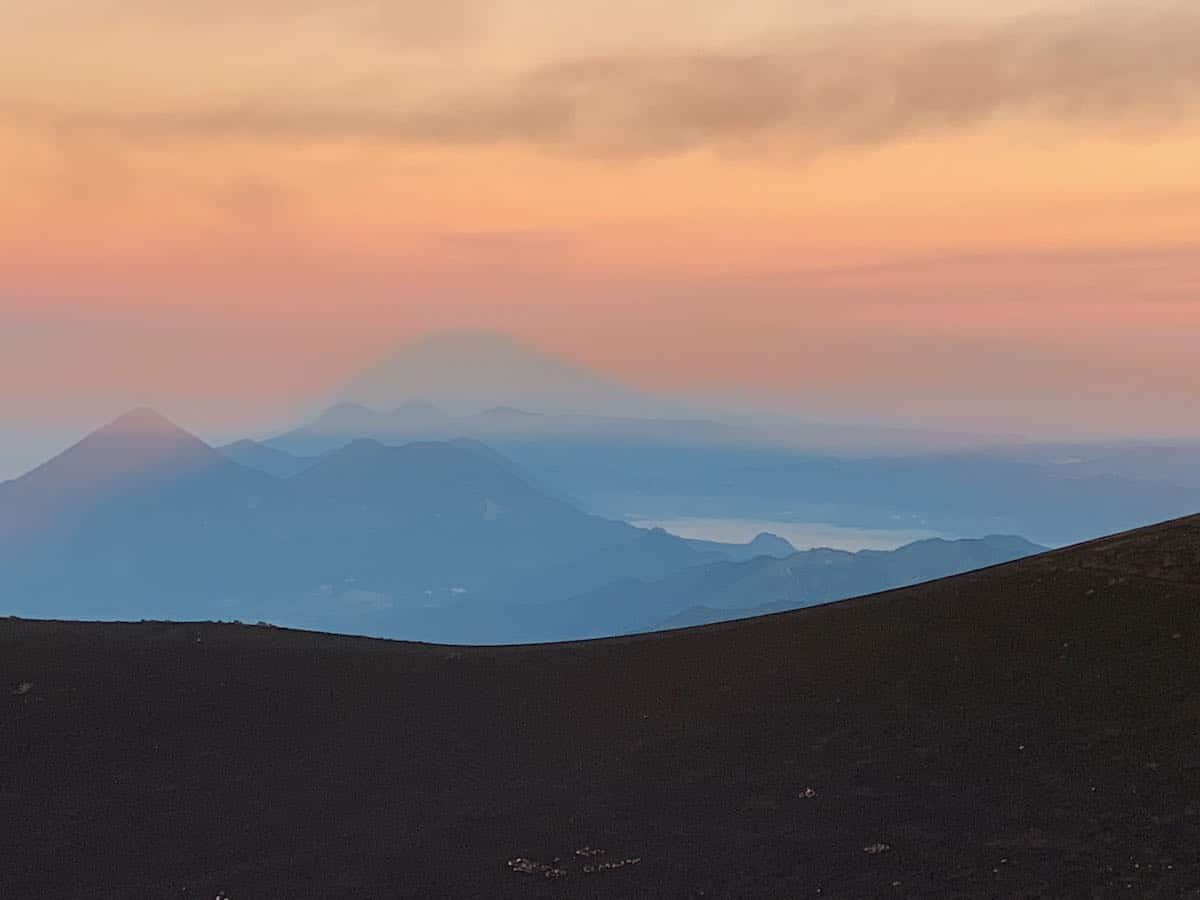
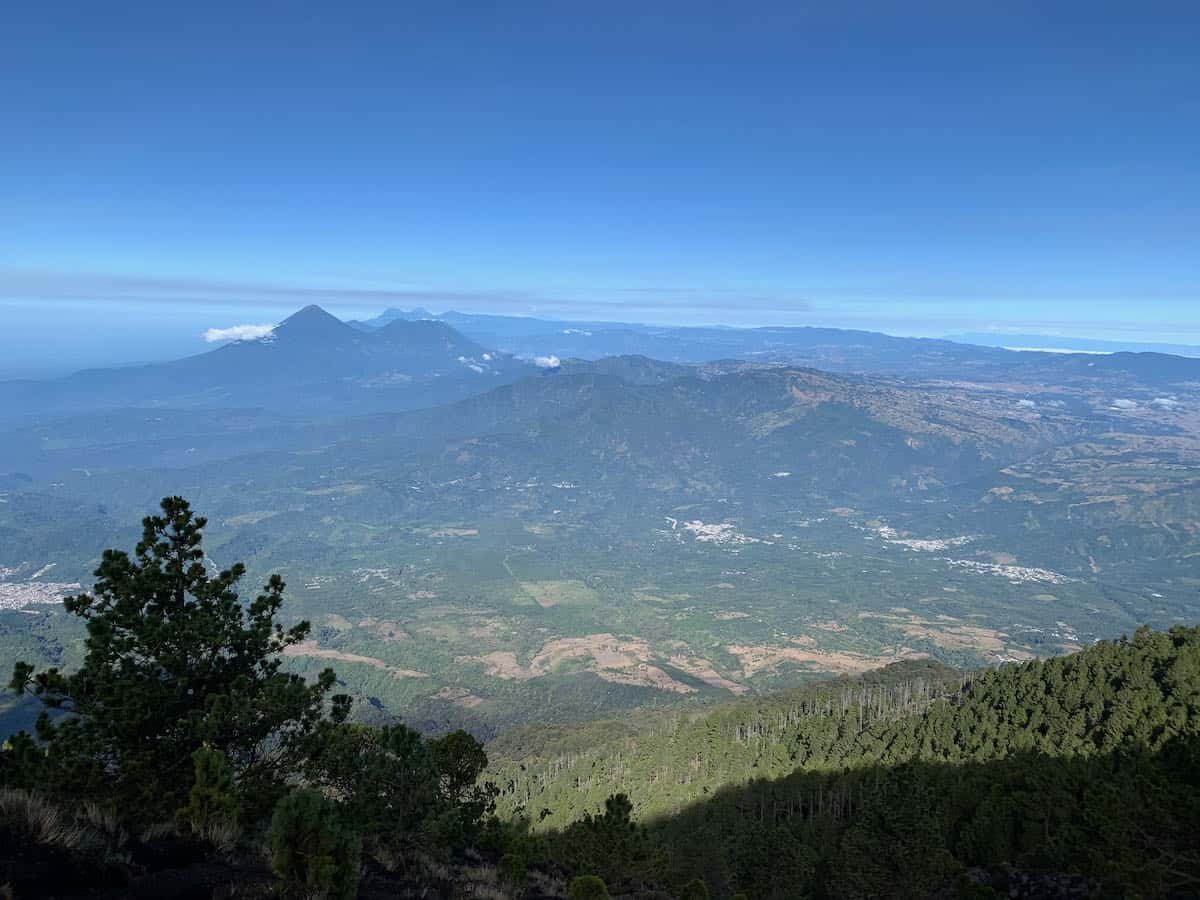
It was magical. Clouds nestled in the valleys, but a clear view of the Pacific ocean on one side and Lake Atitlan on the other, with the lights of Antigua below us. We could see many other volcanoes, some nearby and others in the distance.
We headed back down. This time I was really slow, and Leonel stayed with me and Mark. The other guys probably took about 40 minutes to get back to camp: it took me an hour. But I made it.
Breakfast was waiting for us: prepackaged oatmeal cups that we supplemented with our dried fruit and granola. By 8:30am we were packed up and ready to head down.
The day was spectacular and on the hike down we could see Tajumulco volcano, the tallest of Guatemala’s volcanoes near the Mexican border.
The first half of the hike down was as difficult on my knees as I expected. But I went slowly, with Leonel hanging back with us. It got easier during the second half, and I wasn’t so far behind the rest of the group. We got back to the finca and our cars shortly before 11am.
Leonel took us to lunch at a little restaurant in La Soledad (Los Volcanes) where they give us a lovely lunch of lentils, broccoli salad, and rice (the meat eaters had chicken kebobs). Our adventure was complete except for recovering from aching knees and sleep deprivation.
In the many blog posts I read before we went, authors recommended what to bring. Some of them suggested changes of clothing, which makes no sense: we never took off our clothes the whole time. I did bring an extra pair of socks and an extra light shirt in case I got wet, but I didn’t need to use them.
The main concern is the cold. I had several layers, including:
- Hiking pants
- Long underwear
- Short sleeve shirt
- Long sleeve shirt
- Vest
- Fleece shirt
- Jacket
- Beanie
- Gloves
We also had:
- hiking poles (I could not have done the downhill without them)
- headlamp (not a requirement, but I was glad I had it, both in camp and on the hike up)
- hat for sun protection
- sunscreen
- snacks (nuts, dried fruit, granola, chocolate)
- battery to charge my phone and watch
- ibuprofen
- water
We had two 750ml bottles of water each, and bought another one at the rest area near the end of the hike on the way down. We still would have been fine without it. I had a tiny bottle of electrolytes and I added a few drops to our water along the way.
Overall, what we brought worked well. The only thing I’d do differently is to bring my inflatable sleeping pad.
One of the members of our group felt a bit dizzy at times with the altitude. Neither Mark nor I had any problem with the altitude. l read that ibuprofen would help and I was taking it for my knees anyway. All of us live in Panajachel, at 5100 feet. If you were coming from a lower elevation, the altitude could be a problem.
Since our Acatenango hike, I’ve added some other volcanoes to my bucket list. Stay tuned…
Share this post!
Great to experience the views and comments through your lens and personal observations.
Overall good orientation for anyone else considering the same hike…
Thanks for sharing..
DEL